Category:1969 maps of Kenya
Jump to navigation
Jump to search
Media in category "1969 maps of Kenya"
The following 5 files are in this category, out of 5 total.
-
 Kenya-Uganda boundary. 8-69. LOC 75695706.jpg 3,125 × 4,133; 1.44 MB
-
 Kenya-Uganda boundary. 8-69. LOC 75695706.tif 3,125 × 4,133; 36.95 MB
-
 Kenya. 12-69. LOC 73696378.jpg 6,980 × 7,978; 8.28 MB
-
 Kenya. 12-69. LOC 73696378.tif 6,980 × 7,978; 159.32 MB
-
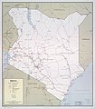
 Kenya. 12-69. LOC gm70003174.jpg 11,926 × 7,989; 13.98 MB


