Category:1969 Atlantic hurricane season track maps
Jump to navigation
Jump to search
Media in category "1969 Atlantic hurricane season track maps"
The following 25 files are in this category, out of 25 total.
-
 07L 1969 track.png 2,700 × 1,669; 2.79 MB
-
 13L 1969 track.png 2,700 × 1,669; 2 MB
-
 1969 Atlantic hurricane 10 track.png 2,700 × 1,669; 2.6 MB
-
 1969 Atlantic hurricane 17 track.png 2,700 × 1,669; 1.09 MB
-
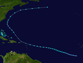
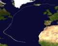
 1969 Atlantic hurricane season summary map.png 4,000 × 2,476; 7.75 MB
-
 1969 Atlantic subtropical storm 1 track.png 2,700 × 1,669; 4.24 MB
-
 1969 Atlantic tropical storm 11 track.png 2,700 × 1,669; 276 KB
-
 1969 Atlantic tropical storm 16 track.png 2,700 × 2,070; 233 KB
-
 26L 1969 track.png 2,700 × 1,669; 631 KB
-
 29L 1969 track.png 2,700 × 1,669; 3.76 MB
-
 Anna 1969 track.png 2,700 × 2,059; 1.35 MB
-
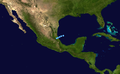 August Atlantic Tropical Depression 1969 track.png 2,700 × 1,669; 3.2 MB
-
 Blanche 1969 track.png 2,700 × 1,669; 1,017 KB
-
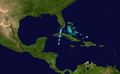
 Camille 1969 path.png 2,700 × 2,032; 2.89 MB
-
 Eve 1969 track.png 2,700 × 1,669; 2.46 MB
-
 Francelia 1969 track.png 2,700 × 1,669; 2.42 MB
-
 Gerda 1969 track.png 2,700 × 2,700; 5.54 MB
-
 Holly 1969 track.png 2,700 × 1,669; 1.38 MB
-
 Debbie 1969 track.png 2,700 × 2,127; 2.8 MB
-
 Inga 1969 track.png 2,700 × 1,710; 521 KB
-
 Jenny 1969 track.png 2,700 × 1,669; 2.89 MB
-
 Kara 1969 track.png 2,700 × 1,694; 1.09 MB
-
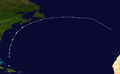
 Laurie 1969 track.png 2,700 × 1,669; 3.3 MB
-
 Camille 1969 track.png 2,700 × 2,032; 2.89 MB
-
 Martha 1969 track.png 2,700 × 1,669; 2.85 MB


