Category:1966 maps of Norway
Jump to navigation
Jump to search
Countries of Europe: Austria · Germany · Italy · Netherlands‡ · Norway · Switzerland · United Kingdom
English: 1966 maps made in Norway or from Norway or showing history of Norway
Media in category "1966 maps of Norway"
The following 8 files are in this category, out of 8 total.
-
 Topographic map of Norway, B32 aust Modalen, 1966.jpg 4,416 × 4,841; 5.26 MB
-
 Topographic map of Norway, D29 aust Skjåk, 1966.jpg 4,380 × 4,839; 4.58 MB
-
 Topographic map of Norway, D30 aust Sygnefjell, 1966.jpg 4,343 × 4,894; 4.7 MB
-
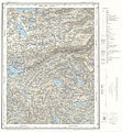
 Topographic map of Norway, E29 aust Vågå, 1966.jpg 4,269 × 4,824; 4.81 MB
-
 Topographic map of Norway, E29 vest Lom, 1966.jpg 4,388 × 4,911; 4.38 MB
-
 Topographic map of Norway, E35 vest Rjukan, 1966.jpg 4,596 × 4,967; 5.39 MB
-
 Topographic map of Norway, F29 vest Sel, 1966.jpg 4,420 × 4,978; 5.17 MB
-
 Topographic map of Norway, U6 Masi, 1966.jpg 7,016 × 5,030; 5.9 MB


