Category:1958 maps of Canada
Jump to navigation
Jump to search
Countries of North America: Canada · Cuba · Jamaica · United States of America‡
‡: partly located in North America
‡: partly located in North America
| ← 1950 1951 1953 1954 1955 1956 1957 1958 |
English: Maps of Canada from 1958 or related to Canada in 1958
Français : Les cartes du Canada de 1958 ou se rapportant au Canada en 1958
Media in category "1958 maps of Canada"
The following 2 files are in this category, out of 2 total.
-
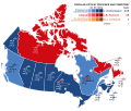 Canada 1958 Federal Election.svg 512 × 435; 264 KB
-
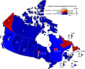 Canada1958.PNG 715 × 580; 48 KB

