Category:1952 maps of the world
Jump to navigation
Jump to search
Media in category "1952 maps of the world"
The following 5 files are in this category, out of 5 total.
-
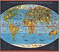
An Illustrated Map of the World from The Golden Geography, 1952.jpg 2,076 × 1,834; 818 KB
-
Members of the United Nations and their dependencies, and Trust Territories, 1951.jpg 1,671 × 1,019; 336 KB
-
Royal Interocean Lines, 1952.jpg 3,322 × 2,500; 4.61 MB
-
The U.S. commitment, 1952.jpg 4,276 × 3,332; 4.93 MB
-
The World - DPLA - 94738bb23d95980684f9d6c862cf3aa5.jpg 11,969 × 7,141; 5.69 MB


