Category:1952 maps of Algeria
Jump to navigation
Jump to search
Media in category "1952 maps of Algeria"
The following 11 files are in this category, out of 11 total.
-
 NI 31-05 - U.S. Army Map Service - 1952 - Saïda.jpg 5,000 × 3,785; 3.86 MB
-
 NI 31-09 - U.S. Army Map Service - 1952 - Géryville.jpg 5,000 × 3,782; 4.43 MB
-
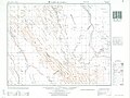
 NI 31-10 - U.S. Army Map Service - 1952 - Laghouat.jpg 5,000 × 3,804; 4.38 MB
-
 NI 31-13 - U.S. Army Map Service - 1952 - El Abiod Sidi Cheikr.jpg 5,000 × 3,790; 3.38 MB
-
 NI 31-14 - U.S. Army Map Service - 1952 - Daiet el Kahla.jpg 5,000 × 3,768; 2.96 MB
-
 NI 31-15 - U.S. Army Map Service - 1952 - Rhardaia.jpg 5,000 × 3,792; 4.19 MB
-
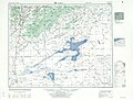
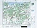
 NJ 31-15 - U.S. Army Map Service - 1952 - Alger.jpg 5,000 × 3,798; 5.26 MB
-
 NJ 31-16 - U.S. Army Map Service - 1952 - Bougie.jpg 5,000 × 3,787; 4.79 MB
-
 NJ 32-09 - U.S. Army Map Service - 1952 - Herbillon.jpg 5,000 × 3,803; 3.04 MB
-
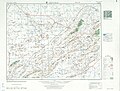
 NJ 32-13 - U.S. Army Map Service - 1952 - Constantine.jpg 5,000 × 3,784; 4.95 MB
-
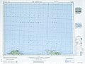
 NJ 32-14 - Series P502 - U.S. Army Map Service - 1952 - Bone.jpg 5,000 × 3,794; 5.19 MB


