Category:1950s Natural Earth maps of the Solar Eclipse
Jump to navigation
Jump to search
Media in category "1950s Natural Earth maps of the Solar Eclipse"
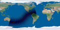
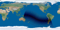
The following 18 files are in this category, out of 18 total.
-
 SE1950Mar18AMglobalC.png 3,600 × 1,800; 5.33 MB
-
 SE1950Sep12TMglobalC.png 3,600 × 1,800; 5.32 MB
-
 SE1951Mar07AMglobalC.png 3,600 × 1,800; 5.37 MB
-
 SE1951Sep01AMglobalC.png 3,600 × 1,800; 5.36 MB
-
 SE1952Aug20AMglobalC.png 3,600 × 1,800; 5.35 MB
-
 SE1952Feb25TMglobalC.png 3,600 × 1,800; 5.33 MB
-
 SE1953Aug09PMglobalC.png 3,600 × 1,800; 5.3 MB
-
 SE1953Feb14PMglobalC.png 3,600 × 1,800; 5.3 MB
-
 SE1953Jul11PMglobalC.png 3,600 × 1,800; 5.28 MB
-
 SE1954Dec25AMglobalC.png 3,600 × 1,800; 5.35 MB
-
 SE1954Jun30TMglobalC.png 3,600 × 1,800; 5.25 MB
-
 SE1956Jun08TMglobalC.png 3,600 × 1,800; 5.34 MB
-
 SE1957Apr30AMglobalC.png 3,600 × 1,800; 5.26 MB
-
 SE1957Oct23TMglobalC.png 3,600 × 1,800; 5.32 MB
-
 SE1958Apr19AMglobalC.png 3,600 × 1,800; 5.33 MB
-
 SE1958Oct12TMglobalC.png 3,600 × 1,800; 5.36 MB
-
 SE1959Apr08AMglobalC.png 3,600 × 1,800; 5.35 MB
-
 SE1959Oct02TMglobalC.png 3,600 × 1,800; 5.35 MB


