Category:1943 maps of Oceania
Jump to navigation
Jump to search
Temperate regions: North America · South America · Africa · Europe · Asia · Oceania – Polar regions: – Other regions:
| ← 1940 1941 1942 1943 1944 1949 → |
Subcategories
This category has only the following subcategory.
S
- Special Map northeast New Guinea (80 F)
Media in category "1943 maps of Oceania"
The following 9 files are in this category, out of 9 total.
-

-

-

-

-
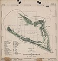
 Abraham, Albert and Allen Islands, Carillon Atoll - NARA - 100359975.jpg 7,736 × 11,678; 3.25 MB
-
 Blanche Bay - NARA - 76059532.jpg 5,920 × 6,662; 4.6 MB
-
 Indonesia. LOC 75696239.jpg 8,829 × 5,980; 6.1 MB
-
 Indonesia. LOC 75696239.tif 8,829 × 5,980; 151.05 MB
-
 Map of Wake Island, 6 October 1943.jpg 2,408 × 2,536; 419 KB


.jpg)


