Category:1942 maps of the world
Jump to navigation
Jump to search
Media in category "1942 maps of the world"
The following 30 files are in this category, out of 30 total.
-
 1942 advertisement map of the world.jpg 8,000 × 6,009; 9.5 MB
-
 1942 Japanese map of the world during World War II verso.tif 8,853 × 6,396; 162.03 MB
-
 1942 Japanese map of the world during World War II.tif 8,808 × 6,369; 160.53 MB
-
 1942 Japanese pictorial map of the world during World War II.tif 10,592 × 4,451; 134.91 MB
-
 1942 Map of the World at War.jpg 4,000 × 2,761; 2.67 MB
-
 1942 map of the world showing the British Commonwealth of Nations.jpg 23,464 × 14,626; 73.76 MB
-
 Aaffc-routes-jun-1942.jpg 1,200 × 862; 227 KB
-
 Arctic arena of the World War II.jpg 1,675 × 2,144; 712 KB
-
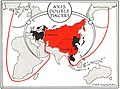 Axis double pincers, 1942.jpg 638 × 474; 100 KB
-
 Esso war map, 1942.jpg 4,160 × 2,900; 4.6 MB
-
 Gomberg map.jpg 3,972 × 2,832; 1.71 MB
-
 Hagstrom's map of the world, 1942.jpg 5,228 × 3,942; 5.24 MB
-
 How arms "Made in U.S.A." supply embattled allies, 1942.jpg 1,983 × 1,262; 1,018 KB
-
 New World map shows vital importance of Alaska.jpg 4,270 × 5,474; 7.66 MB
-
 Newsmap - Monday, October 26, 1942.jpg 28,118 × 20,905; 120.73 MB
-
 Newsmap - Volume 1, Number 3 - DPLA - d7cc1c1bd0b24a86ca28abaf85024a36.jpg 14,999 × 11,335; 20.43 MB
-
 Newsmap -- Monday, September 14, 1942.jpg 28,145 × 21,019; 133.91 MB
-
 Outline of post-war new world map. LOC gm70005331.jpg 11,728 × 8,283; 12.01 MB
-
 Outline of post-war new world map. LOC gm70005331.tif 11,728 × 8,283; 277.93 MB
-
 Pictorial Map of the World During World War II, 1942.jpg 4,000 × 2,590; 2.72 MB
-

-
 Standard map of the World. LOC 00556407.jpg 10,264 × 6,556; 8.44 MB
-
 Standard map of the World. LOC 00556407.tif 10,264 × 6,556; 192.52 MB
-
 The "Time & Tide" Map of the Atlantic Charter.jpg 7,137 × 5,531; 8.59 MB
-
 Total war battle map (35048888911).jpg 2,000 × 883; 1.96 MB
-
 Total war battle map.tif 13,215 × 5,833; 220.56 MB
-
 War map Atlantic, Eurasia, Africa, Pacific Ocean.jpg 3,110 × 4,136; 2.82 MB
-
 World at war, 1942.jpg 5,745 × 3,871; 7.52 MB
-
 World map on Miller cylindrical projection, 1942.jpg 5,709 × 3,047; 6.32 MB
-
 World situation in 1942.jpg 2,363 × 1,588; 1.29 MB


_Atlantique_-_Institut_g%C3%A9ographique_national_-_btv1b531535486.jpg)


.jpg)


