Category:1942 maps of the United States
Jump to navigation
Jump to search
Partly: Indonesia
States of the United States: Louisiana · Michigan · Pennsylvania · Utah · Virginia – Washington, D.C.
Puerto Rico
Puerto Rico
Subcategories
This category has the following 8 subcategories, out of 8 total.
D
L
- 1942 maps of Louisiana (1 F)
M
P
- 1942 maps of Puerto Rico (1 F)
U
V
- 1942 maps of Virginia (2 F)
Media in category "1942 maps of the United States"
The following 4 files are in this category, out of 4 total.
-
 1942 Boston Elevated Railway system map.png 2,102 × 3,500; 21.03 MB
-
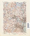 1942 topographic map of Salem USGS.jpg 3,056 × 3,691; 4.62 MB
-
 Air line distances map United States - btv1b531895340.jpg 12,088 × 8,642; 12.18 MB
-


