Category:1941 maps of Europe
Jump to navigation
Jump to search
Temperate regions: North America · South America · Africa · Europe · Asia · Oceania – Polar regions: – Other regions:
English: 1941 maps of Europe
Español: Mapas de Europa en 1941
Suomi: Euroopan kartat vuodelta 1941
Română: Hărți ale Europei din 1941
Subcategories
This category has the following 11 subcategories, out of 11 total.
B
- 1941 maps of Belarus (2 F)
F
- 1941 maps of France (2 F)
G
- 1941 maps of Germany (4 F)
I
- 1941 maps of Italy (3 F)
L
- 1941 maps of Lithuania (1 F)
M
N
- 1941 maps of Norway (20 F)
S
- 1941 maps of Spain (4 F)
- 1941 maps of Switzerland (1 F)
U
- 1941 maps of Ukraine (5 F)
Media in category "1941 maps of Europe"
The following 11 files are in this category, out of 11 total.
-
 12-13 Европа. Физическая карта.jpg 5,498 × 3,393; 5.04 MB
-
 14 Западная Европа. Политическая карта.jpg 2,743 × 3,395; 2.56 MB
-
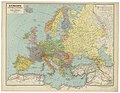
 15 Европа.jpg 2,743 × 3,395; 2.58 MB
-
 22c196 Map1.jpg 630 × 488; 130 KB
-
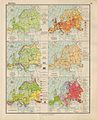
 Ethnic map USSR 1941.jpg 3,560 × 2,194; 3.84 MB
-
-
 German cruiser operations in the Atlantic January to May 1941.jpg 3,005 × 3,359; 6.89 MB
-
 Kildin Saami map.JPG 299 × 242; 32 KB
-
 NatGeo Atlantic Ocean 1941.jpg 3,287 × 4,096; 5.56 MB
-
 The Near and Middle East - Balkan Peninsula.png 1,433 × 1,024; 2.45 MB
-
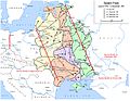
 Источни фронт од јуна 1941 до децембра 1941.png 1,201 × 920; 237 KB


.jpg)


