Category:1935 maps of China
Jump to navigation
Jump to search
Media in category "1935 maps of China"
The following 13 files are in this category, out of 13 total.
-
 1935 Guangdong sheng zuo.png 1,444 × 1,948; 6.94 MB
-
 1935 map of the Tientsin Maneuver Area.jpg 23,355 × 18,790; 58.08 MB
-
 Ca. 1935 map of Shanghai.jpg 18,342 × 12,666; 50.2 MB
-
 AdminChina1935.jpg 2,509 × 1,925; 1.84 MB
-

-
 FormerFrenchConcessionMap.jpg 1,024 × 684; 449 KB
-
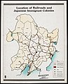
 Japanese pre-war colonization. LOC 80675188-17.jpg 4,033 × 2,865; 1.12 MB
-
 Japanese pre-war colonization. LOC 80675188-18.jpg 3,162 × 3,874; 1.43 MB
-
 Japanese pre-war colonization. LOC 80675188-19.jpg 3,153 × 3,887; 1.48 MB
-
 Japanese pre-war colonization. LOC 80675188-19.tif 3,153 × 3,887; 35.06 MB
-
 Shanghai 1935 S1 AMS-WO.jpg 6,261 × 4,180; 9.96 MB
-
 Shanghai 1935 S2 AMS-WO.jpg 5,080 × 4,468; 8.02 MB
-
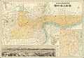
 Transportation map of Manchoukuo (2675974869).jpg 1,796 × 2,000; 2.67 MB


.jpg)