Category:1925 maps of Connecticut
Jump to navigation
Jump to search
States of the United States: Connecticut · Florida · Idaho · Illinois · Kansas · Maryland · Massachusetts · Michigan · Minnesota · New York · Pennsylvania · Utah · Vermont · Wisconsin
| 1925 |
Media in category "1925 maps of Connecticut"
This category contains only the following file.
-
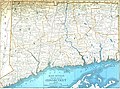 Rand McNally Map of Connecticut.jpg 3,580 × 2,667; 2.82 MB
