Category:1923 maps of the United States
Jump to navigation
Jump to search
States of the United States: California · Delaware · Illinois · Iowa · Louisiana · Maryland · Michigan · Nevada · South Dakota · Utah · Wisconsin · Wyoming – Washington, D.C.
Subcategories
This category has the following 15 subcategories, out of 15 total.
Media in category "1923 maps of the United States"
The following 15 files are in this category, out of 15 total.
-
 1923 Boston Elevated Railway system map.png 3,500 × 4,841; 25.21 MB
-
 1923 fire insurance map of Manchester.jpg 795 × 973; 82 KB
-
 1923 map of motor coach routes in Washington.jpg 4,000 × 3,083; 1.37 MB
-
 1923 map that includes part of Dedham, Westwood, Norwood, and Canton, Massachusetts.jpg 2,264 × 3,703; 1.31 MB
-
 Atlas of the City of Quincy, 1923 - Plate 7.png 3,500 × 2,433; 7.01 MB
-
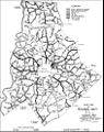
 Bulletin of the Geological Society of America (1923) (14781440042).jpg 1,394 × 3,146; 800 KB
-
 Cambria and Indiana RR map 1923.png 910 × 617; 521 KB
-
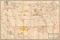 Indian reservations west of the Mississippi River LOC 2008622187.jpg 11,838 × 7,987; 10.46 MB
-
 Indian reservations west of the Mississippi River LOC 2008622187.tif 11,838 × 7,987; 270.51 MB
-
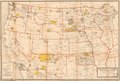
 Indian Reservations west of the Mississippi River. LOC 99446198.jpg 12,326 × 8,512; 14.25 MB
-
 Indian Reservations west of the Mississippi River. LOC 99446198.tif 12,326 × 8,512; 300.18 MB
-
 KDKA-KDPM-WBZ Shortwave relay diagram (1923).jpg 700 × 605; 168 KB
-
 Meck1923.jpg 777 × 982; 177 KB
-
 Oscar Underwood campaign's Great White House Desert map.png 2,794 × 2,058; 257 KB
-
 Proposed Airways Systems of the United States - DPLA - 0ddd7041efce9e89c62baefd3a715f8c.jpg 9,561 × 6,248; 7.62 MB


_(14781440042).jpg)


.jpg)


