Category:1921 maps of Illinois
Jump to navigation
Jump to search
States of the United States: California · Delaware · Hawaii · Idaho · Illinois · Iowa · Louisiana · Maryland · Massachusetts · Michigan · Minnesota · New York · Pennsylvania · South Carolina · South Dakota · Texas · Utah · Virginia · West Virginia · Wyoming
| ← 1920 1921 1922 1923 1924 1925 1926 1927 1928 1929 → |
Subcategories
This category has the following 5 subcategories, out of 5 total.
S
Media in category "1921 maps of Illinois"
The following 11 files are in this category, out of 11 total.
-
 1921 Chicago L map.jpg 3,029 × 2,550; 5.7 MB
-
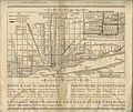
 1921 Railway terminal map of Chicago by Rand McNally.jpg 2,800 × 3,765; 8.15 MB
-
 The Chicago daily news motor guide; (IA chicagodailynews00unse).pdf 1,308 × 2,056, 51 pages; 6.3 MB
-
 Collier's 1921 Illinois.jpg 1,832 × 2,559; 1.37 MB
-
 Sanborn Fire Insurance Map from Bethalto, Madison County, Illinois. LOC sanborn01734 002.jpg 6,450 × 7,650; 4.17 MB
-
 Sanborn Fire Insurance Map from Bethalto, Madison County, Illinois. LOC sanborn01734 002.tif 6,450 × 7,650; 141.17 MB
-
 Sanborn Fire Insurance Map from Elsah, Jersey County, Illinois. LOC sanborn01852 001.jpg 6,450 × 7,650; 3.39 MB
-
 Sanborn Fire Insurance Map from Elsah, Jersey County, Illinois. LOC sanborn01852 001.tif 6,450 × 7,650; 141.17 MB
-
 Sanborn Fire Insurance Map from Wayne City, Wayne County, Illinois. LOC sanborn02217 001.tif 6,450 × 7,650; 141.17 MB
-
 Sanborn Fire Insurance Map from Woodbull, Henry County, Illinois. LOC sanborn02236 001.jpg 6,450 × 7,650; 4.16 MB
-
 Sanborn Fire Insurance Map from Woodbull, Henry County, Illinois. LOC sanborn02236 001.tif 6,450 × 7,650; 141.17 MB


