Category:1921 in Pittsburgh
Jump to navigation
Jump to search
Media in category "1921 in Pittsburgh"
The following 15 files are in this category, out of 15 total.
-
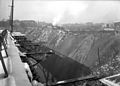
 Cunliffe Hollow Dump (715.216353.CP).jpg 3,000 × 2,157; 1.38 MB
-
 Cunliffe Hollow Dump (715.216354.CP).jpg 3,000 × 2,150; 1.25 MB
-
 East Carson and Smithfield Street (715.215983.CP).jpg 3,000 × 2,174; 1.15 MB
-
 Independence and Wabash Streets (715.216073.CP).png 3,000 × 2,150; 4.88 MB
-
 Independence Street (715.216192.CP).png 3,000 × 2,162; 4.71 MB
-
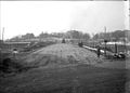
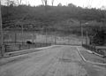
 McKnight Street Bridge (715.216067.CP).jpg 3,000 × 2,161; 1.14 MB
-
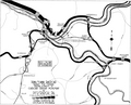
 Pittsburgh area rail map 1921.jpg 10,735 × 5,405; 7.52 MB
-
 Pittsburgh central rail map 1921.jpg 11,821 × 5,886; 14.01 MB
-
 Pittsburgh freight rail density map 1921.jpg 6,510 × 5,447; 4.56 MB
-
 Pittsburgh Pennsylvania Railroad rail freight density 1921.png 2,481 × 2,009; 2.22 MB
-
 Point Bridge Station (715.216004.CP).jpg 3,000 × 2,174; 1.01 MB
-
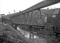
 Shaler Street Bridge (715.216063.CP).jpg 3,000 × 2,157; 1.37 MB
-
 Smithfield Street (715.218439.CP).jpg 3,000 × 2,337; 854 KB
-
 View from the City County Building (715.215136.CP).png 3,000 × 2,378; 4.95 MB
-
 View from the Hill (715.216122.CP).jpg 3,000 × 2,221; 1.72 MB
.jpg)
.jpg)
.jpg)
.png)
.png)
.jpg)


.jpg)
.jpg)
.jpg)
.png)
.jpg)