Category:1920s maps of Hesse
Jump to navigation
Jump to search
Federal states of Germany:
Media in category "1920s maps of Hesse"
The following 3 files are in this category, out of 3 total.
-
 Stadtplan von Wiesbaden, 1927.jpg 6,106 × 6,994; 7.68 MB
-
 Nordhessisches Braunkohlerevier.PNG 646 × 837; 197 KB
-
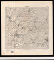 Handschriftlicher Eintrag des Bergbaugebietes auf Meßtischblatt 4823 Melsungen.tif 3,620 × 4,058; 42.05 MB

