Category:1919 maps of Norway
Jump to navigation
Jump to search
English: 1919 maps made in Norway or from Norway or showing history of Norway
Media in category "1919 maps of Norway"
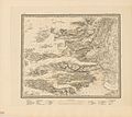
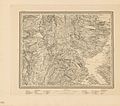
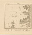
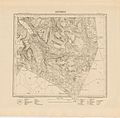
The following 68 files are in this category, out of 68 total.
-
 Akershus amt nr 102- Kopi av kart over Dröbak, 1919.jpg 8,858 × 18,125; 23.81 MB
-
 Ekserserplasskart; Ulven ekserserplads, 1919.jpg 5,157 × 5,276; 2.87 MB
-
 Gradteigsmålinger B34-3, Hordaland, 1919.jpg 7,156 × 7,419; 5.54 MB
-
 Gradteigsmålinger B35-11, Hordaland, 1919.jpg 7,278 × 7,496; 7.25 MB
-
 Gradteigsmålinger E32-10, Buskerud; Oppland, 1919.jpg 7,457 × 7,620; 6.36 MB
-
 Gradteigsmålinger E32-3, Buskerud, 1919.jpg 7,057 × 7,363; 5.66 MB
-
 Gradteigsmålinger E32-6, Buskerud, 1919.jpg 7,368 × 7,598; 7.43 MB
-
 Gradteigsmålinger N7 nv-4, Troms, 1919.jpg 7,259 × 7,248; 5.32 MB
-
 Gradteigsmålinger N7 nø-4, Troms, 1919.jpg 7,318 × 7,519; 7.2 MB
-
 Gradteigsmålinger U8, Finnmark, 1919.jpg 7,150 × 7,139; 5.02 MB
-
 Gradteigsmålinger V3 nordøstre del, Finnmark, 1919.jpg 7,390 × 7,589; 5.4 MB
-
 Gradteigsmålinger V3 sørøstre del, Finnmark, 1919.jpg 7,230 × 7,341; 5.02 MB
-
 Gradteigsmålinger Æ6, Finnmark, 1919.jpg 5,582 × 5,915; 3.36 MB
-

-
-
 Kart over Agershuus Amt, 1919.jpg 6,886 × 8,209; 10.59 MB
-
 Kart over Bratsbergs amt (sør), 1919.jpg 10,724 × 6,677; 15.77 MB
-
 Kart over Buskerud Amt (nord), 1919.jpg 11,339 × 8,022; 18.19 MB
-
 Kart over Buskerud Amt (sør), 1919.jpg 10,748 × 6,791; 12.76 MB
-
 Kart over Grevskabernes Amt, 1919.jpg 6,850 × 8,272; 9.06 MB
-
 Kart over Hedemarkens Amt (midtre), 1919.jpg 10,512 × 7,939; 17.83 MB
-
 Kart over Hedemarkens Amt (nordre), 1919.jpg 11,339 × 8,137; 19.09 MB
-
 Kart over Hedemarkens Amt (sør), 1919.jpg 10,748 × 6,750; 12.04 MB
-
 Kart over Kristians Amt (midtre), 1919.jpg 8,738 × 5,537; 11.16 MB
-
 Kart over Kristians Amt (sør), 1919.jpg 10,783 × 6,777; 13.35 MB
-
 Kart over Lister og Mandals Amt (revidert- S. A. Aarnes og O. Bang), 1919.jpg 7,984 × 9,758; 15.4 MB
-
 Kart over Nordre Bergenhus Amt (nv), 1919.jpg 7,599 × 6,408; 8.87 MB
-
 Kart over Nordre Bergenhus Amt (nø), 1919.jpg 8,150 × 6,876; 8.68 MB
-
 Kart over Nordre Bergenhus Amt (sv), 1919.jpg 8,185 × 6,957; 9.76 MB
-
 Kart over Nordre Bergenhus Amt (sø), 1919.jpg 8,150 × 6,199; 12.17 MB
-
 Kart over Nordre Trondhjems Amt I, 1919.jpg 10,748 × 6,768; 13.14 MB
-
 Kart over Nordre Trondhjems Amt III, 1919.jpg 8,102 × 10,684; 19.28 MB
-
 Kart over Romsdals Amt (nv), 1919.jpg 8,185 × 6,851; 5.24 MB
-
 Kart over Romsdals Amt (sv), 1919.jpg 8,185 × 6,884; 12.41 MB
-
 Kart over Stavanger Amt (nordre), 1919 - 1.jpg 9,402 × 6,777; 12.32 MB
-
 Kart over Stavanger Amt (nordre), 1919.jpg 9,602 × 6,740; 12.03 MB
-
 Kart over Stavanger Amt (søndre), 1919.jpg 9,697 × 6,755; 10.99 MB
-
 Kart over søndre Bergenhus amt (nord), 1919 - 1.jpg 10,713 × 6,760; 20.71 MB
-
 Kart over søndre Bergenhus amt (nord), 1919.jpg 10,384 × 6,163; 16.89 MB
-
 Kart over søndre Bergenhus amt (sør), 1919.jpg 10,748 × 6,760; 14.62 MB
-
 Kart over Søndre Trondhjems Amt, 1919.jpg 8,008 × 9,749; 13.84 MB
-
 Kart over trakten om Aursjöen - Eikisdalen - Litledalen, Høyfjellkommisjonen, 1919.jpg 8,870 × 7,048; 9.78 MB
-
 Kart over Tromsø Amt 10 III, 1919 - 1.jpg 10,843 × 8,395; 9.12 MB
-
 Kart over Tromsø Amt 10 III, 1919.jpg 10,984 × 8,449; 10.5 MB
-
 Rektangelkart Gjøvik 25B, 1919.jpg 6,396 × 5,359; 9.74 MB
-
 Rektangelkart Opdal 42A, 1919.jpg 6,764 × 5,756; 8.59 MB
-
 Rektangelmålinger 19B 11 19B-11, 1919.jpg 6,981 × 7,026; 4.26 MB
-
 Rektangelmålinger 19B 3 sø 19B-3, 1919.jpg 7,078 × 7,226; 3.77 MB
-
 Rektangelmålinger 19B 4 nv 19B-4, 1919.jpg 6,941 × 7,035; 3.89 MB
-
 Rektangelmålinger 19B 4 nø 19B-4, 1919.jpg 6,998 × 7,050; 4.3 MB
-
 Rektangelmålinger 37A 12 37A-12, 1919.jpg 7,054 × 7,219; 5.44 MB
-
 Rektangelmålinger 37A 3; 37A 4 37A-3, 1919.jpg 7,070 × 7,075; 5.74 MB
-
 Rektangelmålinger 37A 7 37A-7, 1919.jpg 6,958 × 7,115; 4.23 MB
-
 Rektangelmålinger 9C 9 9C-9, 1919.jpg 7,374 × 7,336; 6.27 MB
-
 Rektangelmålinger 9C X 9C-X, 1919.jpg 7,119 × 7,172; 3.54 MB
-
 Sjøkart over Oslofjorden.png 3,118 × 3,977; 35.49 MB
-
 Sjøkart over Ryfylkefjordene.png 3,779 × 3,275; 35.42 MB
-
 Topographic map of Norway, A35 Slaaterøy, 1919.jpg 7,419 × 5,944; 4.06 MB
-
 Topographic map of Norway, F34 Krøderen, 1919.jpg 7,395 × 6,149; 10.47 MB
-
 Topographic map of Norway, F35 aust Eiker, 1919.jpg 4,963 × 5,412; 5.51 MB
-
 Topographic map of Norway, F35 Eiker, 1919.jpg 7,018 × 5,400; 10.27 MB
-
 Topographic map of Norway, J14 Meløy, 1919.jpg 7,303 × 6,506; 8.38 MB
-
 Topographic map of Norway, J16 Ranen, 1919.jpg 7,262 × 6,488; 9.59 MB
-
 Topographic map of Norway, J17 Røsvand, 1919.jpg 7,276 × 6,437; 9.55 MB
-
 Topographic map of Norway, K15 Dunderlandsdalen, 1919.jpg 6,147 × 6,021; 9.62 MB
-
 Topographic map of Norway, K16 Umbugten, 1919.jpg 6,357 × 6,584; 7.25 MB
-
 Topographic map of Norway, M7 Bjarkøy, 1919.jpg 5,964 × 6,586; 4.88 MB
-
 Topographic map of Norway, N10 Skjomen, 1919.jpg 6,690 × 6,591; 7.04 MB


,_1919.jpg)
,_1919.jpg)
,_1919.jpg)

,_1919.jpg)
,_1919.jpg)
,_1919.jpg)
,_1919.jpg)
,_1919.jpg)
,_1919.jpg)
,_1919.jpg)
,_1919.jpg)
,_1919.jpg)
,_1919.jpg)


,_1919.jpg)
,_1919.jpg)
,_1919_-_1.jpg)
,_1919.jpg)
,_1919.jpg)
,_1919_-_1.jpg)
,_1919.jpg)
,_1919.jpg)


