Category:1918 maps of Washington, D.C.
Jump to navigation
Jump to search
States of the United States: California · Idaho · Illinois · Iowa · Louisiana · Michigan · Mississippi · New York · North Dakota · Oklahoma · Pennsylvania · South Dakota · Texas · Wisconsin · Wyoming – Washington, D.C.
| ← 1910 1911 1913 1914 1915 1916 1917 1918 1919 → |
Media in category "1918 maps of Washington, D.C."
The following 2 files are in this category, out of 2 total.
-
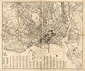 Map of Washington, D.C. LOC 87691478.jpg 9,741 × 8,201; 16.55 MB
-
 Map of Washington, D.C. LOC 87691479.jpg 10,849 × 8,086; 16.55 MB

