Category:1916 maps of Wisconsin
Jump to navigation
Jump to search
States of the United States: California · Idaho · Illinois · Iowa · Kentucky · Louisiana · Maine · Maryland · Massachusetts · Michigan · Minnesota · New Hampshire · New Jersey · New York · North Dakota · Pennsylvania · Rhode Island · South Dakota · Tennessee · Utah · Vermont · West Virginia · Wisconsin – Washington, D.C.
| ← 1910 1911 1912 1913 1914 1915 1916 1917 1918 1919 → |
Media in category "1916 maps of Wisconsin"
The following 4 files are in this category, out of 4 total.
-

-
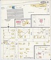
 Sanborn Fire Insurance Map from Union Grove, Racine County, Wisconsin. LOC sanborn09721 004-1.tif 6,450 × 7,650; 141.17 MB
-
-
 Sanborn Fire Insurance Map from Union Grove, Racine County, Wisconsin. LOC sanborn09721 004-2.tif 6,450 × 7,650; 141.17 MB

