Category:1916 maps of Europe
Jump to navigation
Jump to search
Temperate regions: North America · South America · Africa · Europe · Asia · Oceania – Polar regions: – Other regions:
English: 1916 maps of Europe
Español: Mapas de Europa en 1916
Suomi: Euroopan kartat vuodelta 1916
Română: Hărți ale Europei din 1916
Subcategories
This category has the following 15 subcategories, out of 15 total.
.
A
- 1916 maps of Albania (empty)
F
- 1916 maps of France (12 F)
L
- 1916 maps of Lithuania (5 F)
N
- 1916 maps of Norway (33 F)
P
- 1916 maps of Poland (2 F)
R
- 1916 maps of Russia (6 F)
S
- 1916 maps of Spain (2 F)
- 1916 maps of Switzerland (2 F)
T
- 1916 maps of Turkey (2 F)
U
- 1916 maps of Ukraine (7 F)
Media in category "1916 maps of Europe"
The following 17 files are in this category, out of 17 total.
-
1916 map - Flemmings U-Boot-Kriegskarte von Europa.tif 10,149 × 8,200; 34.42 MB
-
1916 nationality map of Europe - the Critical Zone.jpg 1,205 × 1,508; 267 KB
-
1916 physical map Europe.jpg 9,737 × 7,100; 68.91 MB
-
1916 planslavic map of Europe.jpg 1,203 × 1,271; 260 KB
-
1916 political map of Europe.jpg 3,276 × 2,475; 9.61 MB
-
30-Griechenland (1916).png 12,224 × 9,917; 153.63 MB
-
36-U-Boot-Kriegskarte von Europa (1916).png 12,245 × 9,917; 147.58 MB
-
652 Île Longue.jpg 1,494 × 1,920; 1.17 MB
-
Carte des Balkans - btv1b53209992w.jpg 9,931 × 12,221; 22.66 MB
-
De LYser a LAisne, Acervo do Museu Paulista da USP (cropped).jpg 4,359 × 6,407; 35.76 MB
-
De LYser a LAisne, Acervo do Museu Paulista da USP.jpg 5,412 × 7,216; 35.23 MB
-
Distribution of Jewish Population.jpg 1,983 × 1,501; 533 KB
-
Ethnographic Map of Central and South Eastern Europe.jpg 1,932 × 2,576; 648 KB
-
Ethnographical Map of Central and South Eastern Europe - The War Office 1916, London.jpg 1,770 × 1,498; 548 KB
-
Europa BV035084786.jpg 16,197 × 11,327; 24.83 MB
-
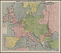
Philips' large scale battle front map of Europe showing the allies' iron ring (5008353).jpg 5,000 × 4,382; 5.09 MB
-
Territory in bird life p88.png 1,780 × 1,196; 808 KB


