Category:1910s maps of the world
Jump to navigation
Jump to search
| 20th-century maps of the world: ← 1900s 1910s 1920s 1930s 1940s 1950s 1960s 1970s 1980s 1990s → |
English: This category is supposed to hold world maps created in the 1910s.
For later created maps showing the history of that decade, see Category:Maps of the world in the 1910s
For later created maps showing the history of that decade, see Category:Maps of the world in the 1910s
Subcategories
This category has the following 10 subcategories, out of 10 total.
- 1910 maps of the world (10 F)
- 1911 maps of the world (15 F)
- 1912 maps of the world (3 F)
- 1913 maps of the world (20 F)
- 1914 maps of the world (9 F)
- 1915 maps of the world (3 F)
- 1916 maps of the world (5 F)
- 1917 maps of the world (9 F)
- 1919 maps of the world (11 F)
Media in category "1910s maps of the world"
The following 11 files are in this category, out of 11 total.
-
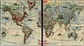 1911 edition.jpg 500 × 276; 45 KB
-

-
 CahillMap-Sepia.png 5,400 × 3,600; 3.06 MB
-
 CahillMap-White.svg 512 × 343; 1.17 MB
-
 French World War I anti-German propaganda - Le Plan Pangermaniste.jpg 11,690 × 15,379; 24.81 MB
-
 Isotherms ugglan.jpg 2,326 × 1,492; 540 KB
-
 Pediment of Tempelhofer Ufer 23–24, Berlin - 2019-10-27 - Andy Mabbett - 01.jpg 3,872 × 2,592; 4.25 MB
-
 Pediment of Tempelhofer Ufer 23–24, Berlin - 2019-10-27 - Andy Mabbett - 02.jpg 3,872 × 2,592; 4.43 MB
-
 The geographical distribution of mammals BHL15579848.jpg 2,569 × 1,674; 356 KB
-
 Wmde tempelhofer ufer 01.12.2013 10-10-38.jpg 2,024 × 2,910; 3.43 MB
-
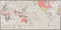 Карта к статье «Колонии» № 1. Военная энциклопедия Сытина (Санкт-Петербург, 1911-1915).jpg 3,865 × 1,894; 1.02 MB

.jpg)


.jpg)