Category:1910s maps of Boston
Jump to navigation
Jump to search
Subcategories
This category has the following 4 subcategories, out of 4 total.
1
- 1911 Boston and vicinity (2 F)
D
- Details of 1910s maps of Boston (20 F)
Media in category "1910s maps of Boston"
The following 33 files are in this category, out of 33 total.
-
 Map of Boston inner harbor (3120131699).jpg 10,040 × 7,008; 7.36 MB
-
 1910 map of Boston subway including proposed Riverbank Subway.jpg 9,032 × 4,808; 5.86 MB
-
 1910 Tremont Street Subway map (14783020073).jpg 1,312 × 1,868; 329 KB
-
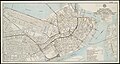
 1911 downtown Boston map.jpg 4,416 × 3,652; 10.14 MB
-

-
 1917 BERy system map.png 3,500 × 4,891; 18.12 MB
-
 1917 BTC subway map.png 3,500 × 3,094; 21.29 MB
-
 A map of the city of Boston in Massachusetts (3121051048).jpg 2,000 × 1,722; 3.54 MB
-
 A practical map of Boston (3719857077).jpg 1,024 × 881; 808 KB
-
 Boston - NARA - 26335516.jpg 6,176 × 8,469; 10.39 MB
-
 Boston molasses area map.png 534 × 462; 108 KB
-
 Boston, a guide book (1910) (14576570240).jpg 2,484 × 3,636; 1.64 MB
-
 Boston, a guide book (1910) (14576610538).jpg 1,804 × 1,692; 508 KB
-
 Boston, a guide book (1910) (14576618589).jpg 2,288 × 3,680; 1.18 MB
-
 Directory map showing small annexations, 1883. LOC 76692161.tif 9,086 × 12,287; 319.4 MB
-

-
 Historical map of the north and central parts of Old Boston (3121051224).jpg 2,000 × 1,461; 3.03 MB
-
-
 Map of Boston (3121050902).jpg 2,000 × 1,654; 3.83 MB
-
 Map of Boston Massachusetts (1914) NSRW.jpg 725 × 699; 215 KB
-
 Map of Brookline and vicinity (9474974168).jpg 799 × 594; 138 KB
-
 Map of the city of Boston and vicinity LOC 80695176.jpg 8,771 × 10,126; 15.86 MB
-
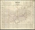
 New Map of the Business Portion of Boston, Tilly Haynes, Macullar, Parker & Co., 1910.jpg 8,883 × 6,290; 23.07 MB
-
 New map of the central portion of Boston (3721027330).jpg 1,024 × 812; 820 KB
-

-
 Plan of Boston (2675452498).jpg 1,265 × 2,000; 2 MB
-
 Post Office Square extension map.jpg 1,986 × 948; 502 KB
-
 Sketch map of Boston and the Public Library system (3121051380).jpg 1,726 × 2,000; 3.21 MB
-
 Sketch map of Boston and the Public Library system (3121051550).jpg 1,419 × 2,000; 2.85 MB
-
 This week in Boston (1905) (14591230489).jpg 2,032 × 1,604; 510 KB
-
 This week in Boston (1905) (14591649769).jpg 1,984 × 1,556; 500 KB
-
 This week in Boston (1905) (14762800001).jpg 1,968 × 1,606; 386 KB
-
 This week in Boston (1905) (14778140115).jpg 1,652 × 2,188; 597 KB
.jpg)

.jpg)


.jpg)
.jpg)


_(14576570240).jpg)
_(14576610538).jpg)
_(14576618589).jpg)
.jpg)
.jpg)
.jpg)
.jpg)
_NSRW.jpg)
.jpg)


.jpg)
.jpg)
.jpg)

.jpg)
.jpg)
_(14591230489).jpg)
_(14591649769).jpg)
_(14762800001).jpg)
_(14778140115).jpg)