Category:1910 maps of California
Jump to navigation
Jump to search
States of the United States: California · Idaho · Illinois · Iowa · Louisiana · Massachusetts · Michigan · Minnesota · Missouri · New Jersey · New York · North Dakota · Ohio · Oklahoma · Pennsylvania · South Dakota · Texas · Utah · Vermont · Virginia · Wisconsin – Washington, D.C.
| ← 1910 1911 1912 1913 1914 1915 1916 1918 1919 → |
Subcategories
This category has the following 3 subcategories, out of 3 total.
Media in category "1910 maps of California"
The following 3 files are in this category, out of 3 total.
-
 Baist's 1910 Real Estate Map Plate 3 with some post-1920 street alignments shown.png 2,101 × 1,459; 6.39 MB
-
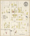
 Sanborn Fire Insurance Map from Snelling, Merced County, California. LOC sanborn00855 001.jpg 8,795 × 10,414; 7.66 MB
-
 Sanborn Fire Insurance Map from Snelling, Merced County, California. LOC sanborn00855 001.tif 8,795 × 10,414; 262.04 MB

