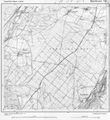
Category:1910 maps of Bavaria
Jump to navigation
Jump to search
Federal states of Germany:
Media in category "1910 maps of Bavaria"
The following 4 files are in this category, out of 4 total.
-
Baierbrunn Georgenstein Michaelstein 1910.jpg 655 × 662; 357 KB
-
Blatt Baierbrunn 1910.png 4,738 × 5,166; 29.15 MB
-
Stadtplan Regensburg - Stadtbauamt - 1910.jpg 11,279 × 7,894; 69.05 MB
-
Umgebungskarte von München (um 1910).jpg 13,217 × 13,261; 78.53 MB


