Category:1908 maps of Massachusetts
Jump to navigation
Jump to search
States of the United States: Alaska · California · Georgia · Idaho · Illinois · Iowa · Louisiana · Maryland · Massachusetts · Michigan · Minnesota · Missouri · Nebraska · Nevada · New York · North Dakota · Ohio · Pennsylvania · South Dakota · Texas · Utah · Virginia · West Virginia · Wisconsin
| ← 1900 1901 1902 1903 1904 1905 1906 1907 1908 1909 → |
Subcategories
This category has only the following subcategory.
M
Media in category "1908 maps of Massachusetts"
The following 8 files are in this category, out of 8 total.
-
 1908 bird's eye view of trolley routes in New England.jpg 4,439 × 6,366; 10.27 MB
-
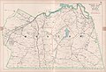 1908 map of Weston, Massachusetts.jpg 5,000 × 3,435; 4.36 MB
-

-
 1908* Edgartown Light area USGS Topo Map.png 1,174 × 952; 1.85 MB
-
 Annual report (1908) (17804298434).jpg 2,768 × 1,502; 500 KB
-
 BCmasterplan.jpg 600 × 272; 123 KB
-
 Map of Boston (3855454667).jpg 1,522 × 2,000; 2.99 MB
-
 Sketch map of Boston and the Public Library system (3856484448).jpg 1,565 × 2,000; 2.11 MB


_(17804298434).jpg)

.jpg)
.jpg)