Category:1906 maps of Illinois
Jump to navigation
Jump to search
States of the United States: California · Georgia · Illinois · Iowa · Kansas · Louisiana · Massachusetts · Michigan · Minnesota · Nevada · New York · North Dakota · Ohio · Pennsylvania · Vermont · West Virginia · Wisconsin
| ← 1900 1901 1902 1903 1904 1905 1906 1907 1908 1909 → |
Subcategories
This category has the following 8 subcategories, out of 8 total.
S
Media in category "1906 maps of Illinois"
The following 41 files are in this category, out of 41 total.
-

-

-
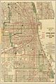 1906 Blanchard's map of Chicago.jpg 7,379 × 11,083; 18.74 MB
-
 Sanborn Fire Insurance Map from Buckley, Iroquois County, Illinois. LOC sanborn01752 002.jpg 6,450 × 7,650; 3.64 MB
-
 Sanborn Fire Insurance Map from Buckley, Iroquois County, Illinois. LOC sanborn01752 002.tif 6,450 × 7,650; 141.17 MB
-
 Sanborn Fire Insurance Map from Fisher, Champaign County, Illinois. LOC sanborn01867 002.jpg 6,450 × 7,650; 3.57 MB
-
 Sanborn Fire Insurance Map from Fisher, Champaign County, Illinois. LOC sanborn01867 002.tif 6,450 × 7,650; 141.17 MB
-

-
 Sanborn Fire Insurance Map from Mansfield, Piatt County, Illinois. LOC sanborn01993 002-1.tif 6,450 × 7,650; 141.17 MB
-

-
 Sanborn Fire Insurance Map from Mansfield, Piatt County, Illinois. LOC sanborn01993 002-2.tif 6,450 × 7,650; 141.17 MB
-

-
 Sanborn Fire Insurance Map from Plymouth, Hancock County, Illinois. LOC sanborn02099 002-1.tif 6,450 × 7,650; 141.17 MB
-

-
 Sanborn Fire Insurance Map from Plymouth, Hancock County, Illinois. LOC sanborn02099 002-2.tif 6,450 × 7,650; 141.17 MB
-
 Sanborn Fire Insurance Map from Cairo, Alexander County, Illinois. LOC sanborn01760 005.jpg 6,450 × 7,650; 3.99 MB
-
 Sanborn Fire Insurance Map from Cairo, Alexander County, Illinois. LOC sanborn01760 005.tif 6,450 × 7,650; 141.17 MB
-

-
 Sanborn Fire Insurance Map from Cordova, Rock Island County, Illinois. LOC sanborn01806 001.tif 6,450 × 7,650; 141.17 MB
-

-
 Sanborn Fire Insurance Map from Hampton, Rock Island County, Illinois. LOC sanborn01910 001.tif 6,450 × 7,650; 141.17 MB
-

-
 Sanborn Fire Insurance Map from Lenzburg, Saint Clair County, Illinois. LOC sanborn01970 001.tif 6,450 × 7,650; 141.17 MB
-
 Sanborn Fire Insurance Map from Loda, Iroquois County, Illinois. LOC sanborn01979 002.jpg 6,450 × 7,650; 3.79 MB
-
 Sanborn Fire Insurance Map from Loda, Iroquois County, Illinois. LOC sanborn01979 002.tif 6,450 × 7,650; 141.17 MB
-

-
 Sanborn Fire Insurance Map from Norris City, White County, Illinois. LOC sanborn02056 001.tif 6,450 × 7,650; 141.17 MB
-
 Sanborn Fire Insurance Map from Piper City, Ford County, Illinois. LOC sanborn02093 001.jpg 6,450 × 7,650; 3.74 MB
-

-
 Sanborn Fire Insurance Map from Port Byron, Rock Island County, Illinois. LOC sanborn02102 001.tif 6,450 × 7,650; 141.17 MB
-
 Sanborn Fire Insurance Map from Sibley, Ford County, Illinois. LOC sanborn02155 002.jpg 6,450 × 7,650; 3.81 MB
-
 Sanborn Fire Insurance Map from Sibley, Ford County, Illinois. LOC sanborn02155 002.tif 6,450 × 7,650; 141.17 MB
-

-
 Sanborn Fire Insurance Map from Springfield, Sangamon County, Illinois. LOC sanborn02163 004.tif 6,450 × 7,650; 141.17 MB
-
 Sanborn Fire Insurance Map from Wyanet, Bureau County, Illinois. LOC sanborn02238 002.jpg 6,450 × 7,650; 3.75 MB
-
 Sanborn Fire Insurance Map from Wyanet, Bureau County, Illinois. LOC sanborn02238 002.tif 6,450 × 7,650; 141.17 MB
-
 Sanborn Fire Insurance Map from Sorento, Bond County, Illinois. LOC sanborn02159 002-1.jpg 6,450 × 7,650; 3.49 MB
-
 Sanborn Fire Insurance Map from Sorento, Bond County, Illinois. LOC sanborn02159 002-1.tif 6,450 × 7,650; 141.17 MB
-
 Sanborn Fire Insurance Map from Sorento, Bond County, Illinois. LOC sanborn02159 002-2.jpg 6,450 × 7,650; 3.54 MB
-
 Sanborn Fire Insurance Map from Sorento, Bond County, Illinois. LOC sanborn02159 002-2.tif 6,450 × 7,650; 141.17 MB
-
 The street railway review (1891) (14736577406).jpg 2,064 × 1,766; 476 KB
_(14596919339).jpg)
_(14803438513).jpg)


_(14736577406).jpg)