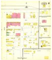
Category:1905 maps of Texas
Jump to navigation
Jump to search
States of the United States: California · Idaho · Illinois · Iowa · Maryland · Minnesota · Missouri · Nevada · New Jersey · New York · North Dakota · Ohio · Oklahoma · Pennsylvania · Texas · Utah · Virginia · Washington · West Virginia · Wisconsin – Washington, D.C.
| ← 1900 1901 1902 1904 1905 1907 1908 1909 → |
Subcategories
This category has only the following subcategory.
Media in category "1905 maps of Texas"
The following 17 files are in this category, out of 17 total.
-
Sanborn Fire Insurance Map from Alvord, Wise County, Texas. LOC sanborn08402 002.jpg 6,667 × 7,838; 2.96 MB
-
Sanborn Fire Insurance Map from Alvord, Wise County, Texas. LOC sanborn08402 002.tif 6,667 × 7,838; 149.51 MB
-
Annual Reports of the Department of the Interior 1905 (1905) (14784356812).jpg 3,234 × 4,554; 2.37 MB
-
Annual Reports of the Department of the Interior 1905 (1905) (14804564853).jpg 3,743 × 5,250; 1.99 MB
-
Sanborn Fire Insurance Map from Arlington, Tarrant County, Texas. LOC sanborn08409 002-1.jpg 6,680 × 7,813; 2.79 MB
-
Sanborn Fire Insurance Map from Arlington, Tarrant County, Texas. LOC sanborn08409 002-1.tif 6,680 × 7,813; 149.32 MB
-
Sanborn Fire Insurance Map from Arlington, Tarrant County, Texas. LOC sanborn08409 002-2.tif 6,660 × 7,784; 148.32 MB
-
Dallas, Texas Map 1905.jpg 5,072 × 6,981; 11.35 MB


