Category:1905 maps of Asia
Jump to navigation
Jump to search
Temperate regions: North America · South America · Africa · Europe · Asia · Oceania – Polar regions: – Other regions:
English: 1905 maps of Asia
Español: Mapas de Asia en 1905
Subcategories
This category has the following 12 subcategories, out of 12 total.
.
G
I
- 1905 maps of India (17 F)
- 1905 maps of Indonesia (6 F)
- 1905 maps of Iran (13 F)
- 1908 maps of Iran (3 F)
J
R
- 1905 maps of Russia (14 F)
T
- 1905 maps of Taiwan (4 F)
Media in category "1905 maps of Asia"
The following 16 files are in this category, out of 16 total.
-
 Area of Sz-chwan compared with British Isles.png 1,096 × 918; 1.34 MB
-
 Asie physique, relief du sol, cours d'eau - par J. Forest... - btv1b530605217.jpg 15,479 × 12,161; 29.55 MB
-
 D065- Voyage des Bak -liv2-ch11.png 1,428 × 1,210; 247 KB
-
 D111- Courants du Pacifique Occidental -liv2-ch11.png 1,440 × 1,548; 334 KB
-
 D191- N° 349. Voyages de Hiuen-Thsang. - liv3-ch09.png 1,442 × 1,882; 368 KB
-
 D217- N° 352. Empire des Fils de Djenghis-Khan. - liv3-ch09.png 1,444 × 1,296; 279 KB
-
 D223- N° 353. Voyages de Marco Polo. - liv3-ch09.png 1,440 × 1,258; 43 KB
-
 D287- N° 366. Théâtre des Conquêtes portugaises. - liv3-ch10.png 1,432 × 1,374; 168 KB
-
 D345- Carte des routes divergentes d’Extrême Orient. -L1-Ch 6.png 1,466 × 1,758; 411 KB
-
 DOUMER-Siam-Map-1906.jpg 2,422 × 3,582; 3.06 MB
-
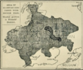
 Friends' District in Sz-Chwan.png 1,582 × 1,356; 2.64 MB
-

-
 Review of reviews and world's work (1890) (14580018330).jpg 2,238 × 2,946; 888 KB
-

-
 The Russo-Afghan Frontier. 1 - 6 589 440 . Garrison Towns. Fortified posts - btv1b8443791b.jpg 10,932 × 7,356; 12.28 MB
-
 The Street railway journal (1905) (14574503429).jpg 3,729 × 2,517; 3.46 MB


_(14796674583)_(cropped).jpg)
_(14580018330).jpg)
_(14796674583).jpg)

_(14574503429).jpg)