Category:1901 maps of the Bahamas
Jump to navigation
Jump to search
Countries of North America: The Bahamas · Canada · United States of America‡
‡: partly located in North America
‡: partly located in North America
| 1901 |
Media in category "1901 maps of the Bahamas"
The following 3 files are in this category, out of 3 total.
-
 Bahamas 1901 Edward Stanford Atlas map.jpg 9,666 × 7,892; 8.1 MB
-
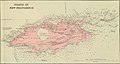
 Nassau old town inset cropped from Bahamas 1901 Edward Stanford Atlas map.jpg 2,951 × 1,791; 809 KB
-
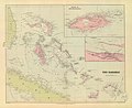
 New Providence Island inset - cropped from Bahamas 1901 Edward Stanford Atlas map.jpg 4,436 × 2,370; 1.4 MB


