Category:1901 maps of Michigan
Jump to navigation
Jump to search
States of the United States: California · Hawaii · Idaho · Illinois · Iowa · Kansas · Maryland · Massachusetts · Michigan · Minnesota · New York · North Dakota · Oklahoma · Pennsylvania · Texas · Vermont · Virginia · Wisconsin – Washington, D.C.
| ← 1900 1901 1902 1903 1904 1906 1907 1908 1909 → |
Subcategories
This category has the following 5 subcategories, out of 5 total.
Media in category "1901 maps of Michigan"
The following 8 files are in this category, out of 8 total.
-
 Dundee, Michigan. Detail from Map of Monroe County 1901.jpg 5,629 × 4,392; 7.74 MB
-
 Map of Monroe County MI by Geo E Lang, 1901.jpg 14,278 × 11,880; 44.86 MB
-
 Map of Monroe County, Michigan LOC 2012593017.jpg 14,278 × 11,880; 31.32 MB
-
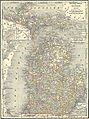 Michigan-1901.jpg 1,860 × 2,492; 4.09 MB
-
 Sanborn Fire Insurance Map from Camden, Hillsdale County, Michigan. LOC sanborn03942 002.jpg 6,510 × 7,707; 3.65 MB
-
 Sanborn Fire Insurance Map from Elkton, Huron County, Michigan. LOC sanborn03998 001.jpg 6,510 × 7,707; 3.93 MB
-

-
 Sanborn Fire Insurance Map from Ubly, Huron County, Michigan. LOC sanborn04220 001.jpg 6,510 × 7,707; 4.02 MB


