Category:1900 maps of Boston
Jump to navigation
Jump to search
Media in category "1900 maps of Boston"
The following 18 files are in this category, out of 18 total.
-
 1900 Boston and Maine Railroad freight terminals map.png 3,500 × 1,877; 14.03 MB
-
 1900 map of Arnold Arboretum.jpg 9,469 × 5,294; 4.46 MB
-

-

-
 Birds-eye view of Boston (2675397456).jpg 2,000 × 1,019; 1.92 MB
-
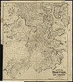 Map of the city of Boston and vicinity (3121052314).jpg 1,763 × 2,000; 3.91 MB
-
 Map of the city of Boston and vicinity (3855456215).jpg 1,941 × 2,000; 4.49 MB
-

-

-

-

-

-

-

-

-

-

-


.jpg)
.jpg)
.jpg)
_(14598266768).jpg)
_(14598290419).jpg)
_(14761959006).jpg)
_(14781807681).jpg)
_(14782590824).jpg)
_(14782594964).jpg)
_(14782596734).jpg)
_(14784595462).jpg)
_(14784948335).jpg)
_(14784949145).jpg)
_(14784951205).jpg)