Category:18th-century maps of the Strait of Magellan
Jump to navigation
Jump to search
Subcategories
This category has only the following subcategory.
F
Media in category "18th-century maps of the Strait of Magellan"
The following 53 files are in this category, out of 53 total.
-
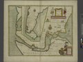
 Plan du détroit de Magellan - M. de Beauchesne - btv1b53123285f (1 of 2).jpg 10,226 × 6,802; 7.02 MB
-
-

-

-

-

-

-

-

-
 Mapa marítimo del Estrecho de Magallanes.jpeg 2,150 × 1,575; 565 KB
-
 Pl. XIV (23394812115).jpg 3,389 × 2,251; 1.37 MB
-

-

-
 Carta reducida del estrecho de Magallanes, fragata de S.M. Santa María de la Cabeza.jpeg 2,234 × 1,575; 561 KB
-

-

-

-

-

-

-
 A map of the straits of Magellan etc - (H. Moll) - btv1b8596641n.jpg 2,112 × 1,538; 576 KB
-

-

-

-

-

-
 Carte des côtes de l'Amérique méridionale - btv1b53121623w.jpg 5,216 × 6,864; 2.96 MB
-

-
 Carte du Detroit de Magellan (19577065841).jpg 8,021 × 4,847; 5.77 MB
-

-

-

-
-

-
 Carte du Détroit de Magelland - LM - btv1b531232912.jpg 10,520 × 5,030; 4.8 MB
-

-
 Carte réduite du Détroit de Magellan - (par J.N.Bellin) - btv1b85966422.jpg 5,829 × 3,552; 3.15 MB
-
 Compagnie des indes orientales 1006733.jpg 3,740 × 1,529; 3.54 MB
-
 Détroit de Magellan - C. Inselin sculp. - btv1b8596639k.jpg 3,289 × 2,400; 1.23 MB
-
 Fretum Magellani - btv1b550105071 (1 of 3).jpg 25,282 × 9,774; 20.32 MB
-

-

-

-
 Le détroit de Magellan... - par le Sr. de Fer. Charles Inselin sculpsit - btv1b8491285n.jpg 6,335 × 4,529; 4.65 MB
-
 Map of the Straits of Magellan and Part of the Land of Fire, Prepared in 1786 WDL52.png 1,511 × 1,024; 2.25 MB
-

-
 Partie du Détroit de Magellan - btv1b531217863.jpg 3,278 × 4,216; 1.54 MB
-
 Plan d'une partie du détroit de Magellan - btv1b53121936s.jpg 6,412 × 4,262; 2.32 MB
-
 Plan du d'Étroit de Magellan - btv1b53123286w.jpg 10,062 × 6,662; 7.71 MB
-

-

-
 Plano del estrecho de Magallanes... - btv1b531232897.jpg 9,500 × 6,428; 3.94 MB
-
 Streight of Magellan accountofvoyages01hawk 0059.jpg 3,527 × 2,576; 444 KB
.jpg)
.jpg)


_par_Li%C3%A9baux_f._-_btv1b59731441.jpg)

.jpg)
_(8443730393).jpg)

.jpg)
_(14597704719).jpg)
.jpg)


_-_btv1b8596641n.jpg)
.jpg)


.jpg)


.jpg)


_-_btv1b85966422.jpg)


.jpg)


.jpg)