Category:18th-century maps of the Bosphorus
Jump to navigation
Jump to search
Subcategories
This category has the following 3 subcategories, out of 3 total.
Media in category "18th-century maps of the Bosphorus"
The following 37 files are in this category, out of 37 total.
-
 Nieuwe accurate en naauwkeurige kaart van de Pontus Euxinus. 1702.jpg 5,274 × 4,468; 3.97 MB
-

-
-

-
-

-

-

-

-

-
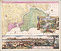
 Bosphorus Thracicus - der Kanal des Schwartzen Meers oder die Meer-Enge bey Constantinopel.tif 8,358 × 12,918; 102.98 MB
-
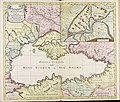
 Carte de la Mer Noire; Carte du canal de la Mer Noire. 1764.jpg 2,960 × 3,448; 1.9 MB
-
 1766 manuscript map of Istanbul and the Bosphorus.jpg 7,602 × 8,986; 13.08 MB
-
 A Plan of Constantinople, Places Adjacent, and the Canal of the Black Sea. . . 1767.jpg 12,010 × 10,322; 27.69 MB
-

-
 A Plan of Constantinople in 1770.jpg 6,932 × 5,507; 8.23 MB
-

-

-
 Plano del canal desde Constantinopla al Mar Negro - Moreno José - 1790.jpg 1,500 × 1,023; 798 KB
-
 1785 - Carte de la ville de Constantinople et du Bosphore de Thrace (cropped).jpg 10,882 × 3,352; 6.91 MB
-

-

-
 Dardanelles to Istanbul RMG K0898.jpg 1,061 × 1,280; 1.36 MB
-
 Continuacion del Mar de Mármara - Moreno José - 1790.jpg 1,500 × 965; 561 KB
-
 A sketch of the Canal of Constantinople RMG K1099.jpg 1,280 × 847; 792 KB
-

-
 1795 map- Charte ueber den Bosporus oder der Straße von Constantinopel (cropped).jpg 2,537 × 2,192; 2.05 MB
-

-
 Schwarzmeer-Gebiet BV039900731.jpg 10,769 × 9,531; 9.93 MB
-

-

-
 Carte de la mer de Marmara, du Bosphore et des Dardanelles - btv1b53100629m (4 of 5).jpg 6,904 × 9,856; 5.49 MB
-
 Carte du Bosphore et de Constantinople - btv1b55010152b (1 of 2).jpg 26,284 × 19,839; 44.85 MB
-
 Carte du Bosphore et de Constantinople - btv1b55010152b (2 of 2).jpg 21,337 × 19,962; 45.77 MB
-
 Carte du canal de la Mer Noire - btv1b53100595b.jpg 23,911 × 9,727; 31.81 MB
-

-


.jpg)


.jpg)


.jpg)


.jpg)


_(14761257486).jpg)
.jpg)
.jpg)


.jpg)
.jpg)
.jpg)


.jpg)