Category:18th-century maps of Western Europe
Jump to navigation
Jump to search
Media in category "18th-century maps of Western Europe"
The following 12 files are in this category, out of 12 total.
-
 1712 Basque districts.png 1,056 × 767; 1.96 MB
-

-

-

-

-

-

-
-
 Guettard-1752-carte mineralogique de la suisse--buache.png 1,130 × 852; 1.07 MB
-
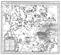 Guettard-1759--mineralogie de l'Auvergne--carte.png 889 × 800; 708 KB
-
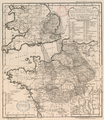
 Map of Western Europe in 1791 by Reilly 0006b.jpg 1,346 × 888; 531 KB
-
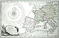 Map of Western Europe in 1791 by Reilly 0006.jpg 1,470 × 952; 591 KB


.jpg)


