Category:18th-century maps of Reims
Jump to navigation
Jump to search
Subcategories
This category has the following 3 subcategories, out of 3 total.
1
- Plan Legendre de Reims (1769) (14 F)
- Plan Coutans de Reims (1775) (14 F)
- Plan Moithey de Reims (1775) (27 F)
Media in category "18th-century maps of Reims"
The following 11 files are in this category, out of 11 total.
-
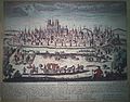 Carte de Reims par Crépy 1741.JPG 3,460 × 2,696; 6.3 MB
-
 Abbaye st-Etienne aux dames claires 1775 Moithey.png 343 × 519; 419 KB
-
 Abbaye st-Pierre-les-Dames Reims 1776.jpg 847 × 907; 501 KB
-
 Isle du Temple 1788 portail de l'église du temple.jpg 1,058 × 568; 392 KB
-
 Plan Reims II 22 378 de 1722.jpg 3,394 × 2,354; 2.46 MB
-
 Plan Terrier 1759 église st-Jacques place d'Erlon rue Vesle.jpg 1,057 × 693; 182 KB
-
 Porte de Soissons 1775 41819.jpg 1,404 × 1,884; 661 KB
-
 Porte médiévale de Mars 1718.jpg 1,294 × 802; 356 KB
-
 PromenaDeS 1731 45476.jpg 2,832 × 974; 2.18 MB
-

-
 Xxiv iii a plan denis geo pour enfant grav germain 1766.jpg 3,504 × 2,480; 2.43 MB


