Category:18th-century maps of Prussia
Jump to navigation
Jump to search
Subcategories
This category has only the following subcategory.
Media in category "18th-century maps of Prussia"
The following 41 files are in this category, out of 41 total.
-
Compendiosa Poloniae Repraesentatio Polen.jpg 5,661 × 4,413; 6.29 MB
-
Land-Charte des Churfürstenthums Brandenburg 1724.jpg 13,568 × 8,400; 37.39 MB
-
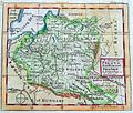
Lithuania on John Cowley map, 1742.jpg 1,255 × 1,065; 420 KB
-
Polish-Lithuanian Commonwealth (Pologne) (Vaugondy, 1748).jpg 2,392 × 1,870; 1.28 MB
-
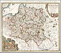
Polish-Lithuanian Commonwealth (Pologne) (Vaugondy, 1749).jpg 3,493 × 3,042; 3.61 MB
-
La Prusse 1751 - Robert de Vaugondy.jpg 1,914 × 1,518; 955 KB
-
Prusse1751Vaugondy aires.png 1,914 × 1,518; 1.52 MB
-
Polish-Lithuanian Commonwealth (Pologne) (Vaugondy, 1756).jpg 1,039 × 909; 401 KB
-
1757 Revel detail of map Russians March to Prussia BPL 14326.png 559 × 714; 886 KB
-
1757 Windaw detail of map Russians March to Prussia BPL 14326.png 559 × 714; 887 KB
-
Tobias Mayer Carte de la Pologne 1757.jpg 1,789 × 1,570; 1.79 MB
-
Borussiae regnum.jpg 1,173 × 817; 909 KB
-
Jeu des cartes géographiques - S. L. Hegrad (21) - La Prusse.jpg 1,567 × 2,758; 557 KB
-
Mayer - Les royaumes de Pologne et de Prusse.jpg 1,684 × 1,330; 2.48 MB
-
Toeppen Preussen 1772.jpg 6,700 × 5,526; 4.03 MB
-
A new map of the Kingdom of Poland with its dismembered provinces (1787).jpg 10,266 × 6,848; 14.09 MB
-
Map of the Empire of Germany (Delarochette, 1790).jpg 9,900 × 8,366; 20.43 MB
-
Map of Poland and Prussia in 1791 by Reilly 034.jpg 1,281 × 862; 506 KB
-
Map of Prussia in 1791 by Reilly 051.jpg 1,024 × 768; 271 KB
-
Map of Prussia in 1791 by Reilly 051b.jpg 1,116 × 847; 446 KB
-
Map of Prussia in 1791 by Reilly 056.jpg 1,092 × 892; 365 KB
-
Karte von Polen und den angränzenden Provinzen 02.jpg 5,582 × 4,572; 6.65 MB
-
Regno di Prussia (Antonio Zatta 1794, twelve small maps).jpg 541 × 378; 78 KB
-
Polen Litauen und Kurland im Jahr 1796.jpg 7,331 × 5,986; 13.85 MB
-
Franz Ludwig Güssefeld-Charte von Neuschlesien1799.png 650 × 583; 655 KB
-
1799 Cary Map of Poland, Prussia and Lithuania - Geographicus - Poland-cary-1799.jpg 5,000 × 4,416; 7.6 MB
-
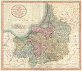
1799 Cary Map of Prussia and Lithuania - Geographicus - Prussia-cary-1799.jpg 5,000 × 4,364; 6.48 MB
-
Map of Prussia in 1791 by Reilly 052.jpg 1,071 × 882; 447 KB
-
Map of Prussia in 1791 by Reilly 053.jpg 640 × 480; 155 KB
-
Map of Prussia in 1791 by Reilly 054.jpg 1,117 × 917; 447 KB
-
Map of Prussia in 1791 by Reilly 055.jpg 1,111 × 947; 538 KB
-
Potsdam um 1785.JPG 1,180 × 820; 428 KB


