Category:18th-century maps of New England
Jump to navigation
Jump to search
Maps created between 1700 and 1799, showing multiple or all of the following states, may be sorted directly into this category: Maine, New Hampshire, Vermont, Massachussetts, Connecticut, Rhode Island. Maps that show just two or less of the New England states, should be sorted into the categories of the respective states.
Maps that also show large parts or all of New York, New Jersey and Pennsylvania, should be sorted into "Maps of the Northeastern United States" instead.
Subcategories
This category has the following 11 subcategories, out of 11 total.
- 1750s maps of New England (5 F)
- 1770s maps of New England (12 F)
- 1780s maps of New England (7 F)
1
C
M
N
R
V
Media in category "18th-century maps of New England"
The following 7 files are in this category, out of 7 total.
-
 An exact mapp of New England and New York (NYPL b15079225-434822).jpg 5,290 × 4,768; 4.85 MB
-
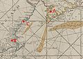
 Part of New England (10208128234).jpg 800 × 655; 144 KB
-
 BayOfMaine1713.jpg 2,761 × 1,958; 2.23 MB
-
 Approximate route of Sarah Kemble Knight's Journey, 1704-1705.png 1,100 × 788; 1.65 MB
-
 A large draught of New England, New York and Long Island (2675697244).jpg 2,000 × 1,616; 3.02 MB
-
-
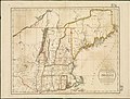
 Newengland2.jpg 800 × 640; 153 KB
.jpg)
.jpg)


.jpg)
.jpg)
