Category:18th-century maps of Lower Saxony
Jump to navigation
Jump to search
Federal states of Germany:
Subcategories
This category has the following 8 subcategories, out of 8 total.
- 1730s maps of Lower Saxony (4 F)
- 1750s maps of Lower Saxony (9 F)
Media in category "18th-century maps of Lower Saxony"
The following 21 files are in this category, out of 21 total.
-

-
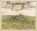 1732 illustration of Blocksberg.jpg 14,017 × 12,060; 25.49 MB
-
 Reilly Allgemeiner Postatlas Westfalen, Burgund.jpg 1,768 × 1,432; 935 KB
-
 Bardowick 1704 img02.jpg 874 × 700; 400 KB
-
 Burg Campen 1740 Lagekarte.jpg 1,036 × 732; 185 KB
-
 Calenberg 1771.jpg 1,690 × 1,251; 2.38 MB
-
 Emden1730.jpg 388 × 345; 67 KB
-

-
 Flechtorf mit Burg Campen 1740 Lagekarte.jpg 1,296 × 978; 1.05 MB
-
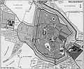 Grundriss Helmstedt 1764.jpg 1,610 × 1,326; 424 KB
-
 Güssefeld, Karte der Braunschweigischen Lande, 1786.jpg 2,924 × 2,316; 4.72 MB
-

-
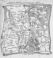 Northeim Karte 1779.jpg 940 × 1,021; 484 KB
-

-
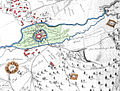
 Plan de Postitione del arme allier a 24. dez 1757 9106.jpg 3,032 × 4,613; 3.46 MB
-
 Plan of Emden, erschienen 1758 in London.jpg 1,803 × 3,072; 1.53 MB
-
 Reichskreis Niederrhein-Westfalen 1710.jpg 1,978 × 2,400; 2.09 MB
-
 Salzliebenhall - Schuchartsche Karte 1725.jpg 4,181 × 1,869; 5.85 MB
-
 Truper Blänken 1764.jpg 746 × 474; 64 KB
-
-


