Category:18th-century maps of Louisbourg
Jump to navigation
Jump to search
Media in category "18th-century maps of Louisbourg"
The following 42 files are in this category, out of 42 total.
-
 Plan du naufrage du navire le Chameau levé en 1725.jpg 785 × 695; 178 KB
-
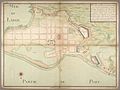
 Plan de Louisbourg - 1732.jpg 2,000 × 1,962; 865 KB
-

-

-

-

-

-
-

-

-
 Profil du Revettement propose en maconnerie du Quay de Louisbourg.jpg 2,000 × 668; 125 KB
-
 Carte de 1735 relatant le naufrage du Chameau survenu en 1725.jpg 1,058 × 822; 280 KB
-

-
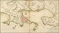
 Verrier Louisbourg 1735 ANOM 3 DFC 185B.jpg 3,543 × 2,307; 1.89 MB
-
 Verrier Louisbourg 1737 ANOM C11B39 102.jpg 1,504 × 1,054; 360 KB
-
 Verrier PLan de la ville de Louisbourg 1737.jpg 1,253 × 600; 324 KB
-
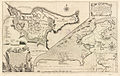
 Capebretonisland.jpg 800 × 600; 112 KB
-
 Capebretonislandne.jpg 800 × 600; 126 KB
-
 Capebretonislandnw.jpg 800 × 600; 131 KB
-
 Capebretonislandse.jpg 800 × 600; 120 KB
-
 Capebretonislandsw.jpg 800 × 600; 122 KB
-
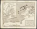
 128 of 'A half-century of conflict. (1700-1748.)' (11219058086).jpg 2,192 × 1,380; 469 KB
-
 146 of 'A half-century of conflict. (1700-1748.)' (11214916674).jpg 2,192 × 1,380; 538 KB
-

-

-
 Plan of Louisbourg (June 17, 1745).jpg 539 × 700; 144 KB
-
 Louisbourg - btv1b8493716r.jpg 11,614 × 8,138; 10.3 MB
-
 Carte de 1750 - 1751 de l'île Royale avec Louisbourg.jpg 1,550 × 805; 476 KB
-
 Détail d'une carte de 1750 - 1751 sur l'île Royale.jpg 1,403 × 735; 324 KB
-
 Plan de Louisbourg vers 1751.jpg 1,559 × 878; 475 KB
-

-

-
 A plan of the city, and fortifications, of Louisburg (2675080034).jpg 2,000 × 1,271; 2.45 MB
-
 Plan défensif de Louisbourg en 1757.jpg 1,527 × 989; 499 KB
-
 A plan of the city & fortifications of Louisburg (4231928552).jpg 2,000 × 1,282; 2.81 MB
-
 A plan of the city & fortifications of Louisburg (4579368312).jpg 3,195 × 2,047; 4.33 MB
-
-
 A Plan of the City & Harbour of Louisburg.jpg 3,371 × 2,775; 2.84 MB
-
 Plan de la ville et du port de Louisbourg levé en 1756 (5961375444).jpg 2,000 × 1,516; 2.75 MB
-
 Partie du port de Louisbourg - btv1b7100377q (1 of 2).jpg 8,178 × 6,102; 3.76 MB
-
 Louisbourg-08851 - Royal Battery Drawing (50232141167).jpg 6,140 × 4,211; 9.29 MB
-
 Fortress Louisbourg Map (50232267932).jpg 2,000 × 1,600; 2.15 MB


%27_(11219058086).jpg)
%27_(11214916674).jpg)
%27_(11010376904).jpg)
_(14777526714).jpg)
.jpg)


.jpg)

.jpg)
.jpg)
.jpg)

.jpg)
.jpg)
.jpg)
.jpg)