Category:18th-century maps of Catalonia
Jump to navigation
Jump to search
Media in category "18th-century maps of Catalonia"
The following 22 files are in this category, out of 22 total.
-

-
 Map - Special Collections University of Amsterdam - OTM- HB-KZL 32.25.30.tiff 7,340 × 6,337; 133.08 MB
-

-
 Batalla de prats de Rei.jpg 1,024 × 1,279; 602 KB
-
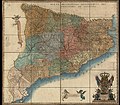
 Mapa anglès del Camp de Tarragona.jpg 5,910 × 4,374; 5.41 MB
-

-

-
 1769 edition of the 1720 map of the Principality of Catalonia by Josep Aparici i Fins.jpg 15,941 × 14,167; 44.73 MB
-

-
 Reproducció d'un mapa de Catalunya d'Aparici (AFCEC VINTRO D 4123).jpeg 1,024 × 682; 145 KB
-

-
 RM.4539.jpg 8,260 × 7,200; 23.98 MB
-

-
 Sección-mapa-1745-Rosellón.png 629 × 269; 379 KB
-

-
 Mapa Estany de Castelló d'Empúries 01.jpg 1,410 × 1,600; 611 KB
-

-
 1762- Vegueries 1762.jpg 4,381 × 3,272; 2.42 MB
-
 William Faden. Composite Mediterranean. 1785.KF.jpg 674 × 560; 118 KB
-
 Reproducció d'un mapa de Catalunya de 1792 de Placide (AFCEC VINTRO D 4113).jpeg 1,024 × 682; 141 KB
-

-

_Les_Forces_de_l%27Europe,_Asie,_Afrique_et_Amerique,_ou_description_des_principales_villes_avec_leurs_for,_RP-P-OB-83.034-312.jpg)


.jpeg)


.jpeg)
.jpeg)

_Les_Forces_de_l%27Europe,_Asie,_Afrique_et_Amerique_Comme_aussi_les_Cartes_des_C%C3%B4tes_de_France_et_d%27Espagne_(,_RP-P-OB-83.035-136.jpg)

_-_Geographicus_-_Catalogne-ratelband-1747.jpg)

.jpg)


.jpeg)
_Les_Principales_Forteresses_%26_Villes_Fortes,_d%27Espagne,_de_France,_d%27Italie,_de_Savoi%C3%AB,_d%27Allemagne_%26_,_RP-P-2015-62-4.jpg)
_-_por_D._Tomas_Lopez..._-_btv1b53021224j_(1_of_2).jpg)