Category:1898 maps of Africa
Jump to navigation
Jump to search
Temperate regions: North America · South America · Africa · Europe · Asia · – Polar regions: – Other regions:
| ← 1890 1891 1892 1893 1894 1895 1896 1897 1898 1899 → |
Media in category "1898 maps of Africa"
The following 45 files are in this category, out of 45 total.
-
-

-

-

-
-

-

-

-

-

-

-

-
 142 of 'Viagens de Pedro da Covilhan' (11291768654).jpg 1,356 × 1,036; 370 KB
-
 153 of 'The “Beaumont” Geography and Map Tracing Book' (11247364174).jpg 2,026 × 2,512; 1.09 MB
-
 155 of 'The “Beaumont” Geography and Map Tracing Book' (11247230783).jpg 2,024 × 2,483; 1.05 MB
-

-
 1898 Niger map byJohnston BPL m0612007.png 545 × 749; 714 KB
-
 Muhammadan Africa-1899.jpg 560 × 760; 103 KB
-
 239 of 'Pitman's Commercial Geography of the World' (11247948903).jpg 1,312 × 1,942; 606 KB
-

-

-

-

-
 Africa - DPLA - aaaf233612c89ebebdaf5d8949515472.jpg 741 × 1,000; 227 KB
-
 Africa - DPLA - b62e314047ba880e5eee759e17b49723.jpg 648 × 1,000; 174 KB
-

-
 Carte de la Boucle du Niger dressee par Le Lieutenant Spicq.jpg 33,256 × 24,816; 169.57 MB
-
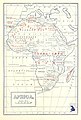
 Equatorial & Southern Africa - DPLA - b6b8a25f582c836c2c83db101a05e75a.jpg 981 × 1,000; 286 KB
-
 Itinéraire de la mission E. Gentil 1895-1898 - btv1b8441892g.jpg 4,139 × 4,544; 1.81 MB
-

-

-
 Map of the Niger Country in 1898.jpg 3,760 × 1,989; 694 KB
-

-

-
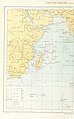
 Sketch Map of British Somaliland - DPLA - fb8874a12ddaa4cb7ff7c245dcdb34a1.jpg 1,000 × 680; 207 KB
-
 Sketch Map of Central Angoniland - DPLA - 1e5c290cbeb53c46bf73af931467c657.jpg 1,000 × 803; 225 KB
-
-

-
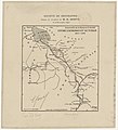
 Sketch Map of the Mweru District - DPLA - 3aa473b23389960ed8a226cc935331c8.jpg 1,000 × 638; 149 KB
-
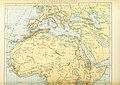
 Sketch-Map of Southern Tunis… - DPLA - 6302b5e7c28219fd790488f440ccfd85.jpg 973 × 1,000; 266 KB
-

-
 The "Daily Mail" commercial map of Africa - the Cape-Town to Cairo route. LOC 2019589339.tif 6,553 × 7,483; 140.29 MB
-
 Traversée de l'Afrique du Zambèse au Congo - par Edouard Foa, 1894-1897 - btv1b8441766n.jpg 7,209 × 5,784; 4.74 MB
-

-
 W. & A.K. Johnstons maps to illustrate the Niger and Upper Nile questions (2675651104).jpg 1,711 × 2,000; 3.17 MB
%27_(11246030014).jpg)
%27_(11245672816).jpg)
%27_(11244898964).jpg)
%27_(11245236036).jpg)
%27_(11246433455).jpg)
%27_(11248396823).jpg)
%27_(11248114035).jpg)
%27_(11246861906).jpg)
%27_(11246337134).jpg)
%27_(11245760413).jpg)
%27_(11295474284).jpg)
.jpg)
.jpg)
.jpg)
.jpg)
%27_(11246906075).jpg)


.jpg)
.jpg)
,_etc%27_(11292758885).jpg)
%27_(11246129955).jpg)


.jpg)