Category:1897 maps of New Jersey
Jump to navigation
Jump to search
States of the United States: Alaska · California · Connecticut · Delaware · Florida · Georgia · Idaho · Illinois · Iowa · Kansas · Kentucky · Maryland · Michigan · Minnesota · Mississippi · Missouri · Montana · Nevada · New Jersey · New York · North Carolina · North Dakota · Ohio · Oregon · Pennsylvania · South Carolina · South Dakota · Tennessee · Texas · Virginia · Washington · West Virginia · Wisconsin – Washington, D.C.
| ← 1890 1891 1892 1895 1896 1897 1898 1899 → |
Subcategories
This category has the following 11 subcategories, out of 11 total.
S
Media in category "1897 maps of New Jersey"
The following 17 files are in this category, out of 17 total.
-
 Asbury Park, Ocean Grove and vicinity, New Jersey 1897. LOC 75694715.jpg 12,592 × 10,016; 30.34 MB
-
 Asbury Park, Ocean Grove and vicinity, New Jersey 1897. LOC 75694715.tif 12,592 × 10,016; 360.84 MB
-

-
-
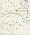
 Sanborn Fire Insurance Map from Blairstown, Warren County, New Jersey. LOC sanborn05421 001.tif 6,450 × 7,650; 141.17 MB
-

-
-

-
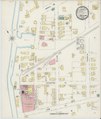
 Sanborn Fire Insurance Map from Helmetta, Middlesex County, New Jersey. LOC sanborn05506 001.tif 6,450 × 7,650; 141.17 MB
-

-
 Sanborn Fire Insurance Map from Jamesburg, Middlesex County, New Jersey. LOC sanborn05512 001.tif 6,450 × 7,650; 141.17 MB
-

-
 Sanborn Fire Insurance Map from Old Bridge, Middlesex County, New Jersey. LOC sanborn05581 001.tif 6,450 × 7,650; 141.17 MB
-

-
 Sanborn Fire Insurance Map from Scotch Plains, Union County, New Jersey. LOC sanborn05623 001.tif 6,450 × 7,650; 141.17 MB
-

-
 Sanborn Fire Insurance Map from Spotswod, Middlesex County, New Jersey. LOC sanborn05631 001.tif 6,450 × 7,650; 141.17 MB


