Category:1896 maps of Germany
Jump to navigation
Jump to search
Countries of Europe: Armenia‡ · France‡ · Georgia‡ · Germany · Italy · Norway · Poland · Spain‡ · United Kingdom
‡: partly located in Europe
‡: partly located in Europe
Federal states of Germany:
Subcategories
This category has only the following subcategory.
'
Media in category "1896 maps of Germany"
The following 9 files are in this category, out of 9 total.
-
 Berlin Kaiser Wilhelm Nationaldenkmal Lageplan.jpg 2,721 × 1,930; 824 KB
-
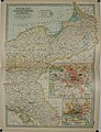
 Historische Karte vom Zuchtgebiet des Vogelsberger Rindes.jpg 3,604 × 2,549; 5.03 MB
-
 Reise-bzwEisenbahnkarte Deutschland1896.jpg 3,811 × 3,004; 6.4 MB
-

-
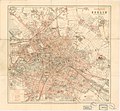
 Straube Plan von Berlin 1896.jpg 4,196 × 3,329; 6.14 MB
-
 Straube Taschenplan von Berlin 1896.jpg 4,268 × 3,953; 6.24 MB
-
-

-


_(14590009058).jpg)
_(14776659385).jpg)
_(14796513533).jpg)