Category:1895 maps of Russia
Jump to navigation
Jump to search
Media in category "1895 maps of Russia"
The following 7 files are in this category, out of 7 total.
-
TB(1895) p593 Map showing the Route to Kolguev Island and retour.jpg 3,861 × 2,345; 4.87 MB
-
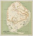
TB(1895) p595 Map of Kolguev Island.jpg 2,159 × 2,335; 2.27 MB
-
TB(1895) p597 Map of the Arctic Portions of European Russia.jpg 3,155 × 2,295; 3.64 MB
-
1895. Карта азиатской России.jpg 12,058 × 10,049; 25.2 MB
-
199 of 'The Peoples and Politics of the Far East, etc' (11303728603).jpg 1,488 × 1,305; 378 KB
-
Novgorod plan 1895.jpg 7,423 × 5,251; 5.03 MB
-
Plan SPB wells 1895.jpg 3,923 × 4,119; 3.94 MB


