Category:1892 maps of Europe
Jump to navigation
Jump to search
Temperate regions: North America · South America · Africa · Europe · Asia · Oceania – Polar regions: – Other regions:
English: 1892 maps of Europe
Español: Mapas de Europa en 1892
Suomi: Euroopan kartat vuodelta 1892
Română: Hărți ale Europei din 1892
Subcategories
This category has the following 8 subcategories, out of 8 total.
.
F
- 1892 maps of France (11 F)
G
L
- 1892 maps of Lithuania (4 F)
N
- 1892 maps of Norway (9 F)
R
- 1892 maps of Russia (2 F)
S
- 1892 maps of Spain (6 F)
Media in category "1892 maps of Europe"
The following 5 files are in this category, out of 5 total.
-

-
 Brockhaus' Konversations-Lexikon (1892) (14781481045).jpg 1,558 × 2,566; 702 KB
-
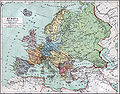 Europa 1890.jpg 2,500 × 1,956; 1.84 MB
-
 The birds of Devon (6140210657).jpg 1,466 × 1,269; 238 KB
-
 Western Europe in the Time of Charles V (1525).png 863 × 1,160; 2.08 MB
.jpg)
_(14781481045).jpg)

.jpg)
.png)