
Category:1891 maps of South America
Temperate regions: North America · South America · Africa · Europe · Asia · – Polar regions: – Other regions:
| ← 1890 1891 1892 1893 1894 1895 1896 1897 1898 1899 → |
Subcategories
This category has the following 2 subcategories, out of 2 total.
Media in category "1891 maps of South America"
The following 19 files are in this category, out of 19 total.
-
-
 Universiteitsbibliotheek VU - Missions-Weltkarte ca 1891 (detail).jpg 559 × 630; 392 KB
-
 Neu Germania pg169 11211535785.jpg 3,661 × 2,754; 2.42 MB
-
-
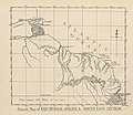
 96 of '(Longmans' Junior School Geography, etc.)' (11208716294).jpg 2,704 × 2,001; 849 KB
-
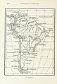
 96 of 'Longmans' Junior School Geography, etc' (11197640813).jpg 2,752 × 1,969; 759 KB
-
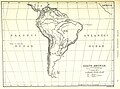 97 of '(Longmans' Junior School Geography, etc.)' (11213534475).jpg 2,704 × 2,001; 894 KB
-

-
 Life-expectancy,South America,1891.svg 850 × 691; 149 KB
-
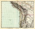
 Map of the Republic of Colombia WDL11318.png 1,024 × 1,137; 1.93 MB
-

-

-
 Stielers Handatlas 1891 89.jpg 5,050 × 4,300; 4.54 MB
-
 Stielers Handatlas 1891 90.jpg 5,050 × 4,300; 5.71 MB
-
 Stielers Handatlas 1891 91.jpg 5,150 × 4,300; 4.55 MB
-
 Stielers Handatlas 1891 92.jpg 5,150 × 4,300; 5.04 MB
-
 Stielers Handatlas 1891 93.jpg 5,100 × 4,300; 5.11 MB
-
 Stielers Handatlas 1891 94.jpg 5,100 × 4,450; 5.36 MB
-
 Stielers Handatlas 1891 95.jpg 5,100 × 4,300; 4.23 MB
.jpg)
.jpg)

.jpg)
%27_(11208716294).jpg)
.jpg)
%27_(11213534475).jpg)
.jpg)


_(14582626150).jpg)


_-_por_C._Opitz_;_..._i_Dr_H._Polakowsky..._-_btv1b53027914v.jpg)