Category:1890s maps of Jerusalem
Jump to navigation
Jump to search
Media in category "1890s maps of Jerusalem"
The following 23 files are in this category, out of 23 total.
-

-
 Haram-al-sharif-plan-1890.jpg 909 × 847; 135 KB
-
 217 of 'Buried Cities and Bible Countries' (11298370556).jpg 1,325 × 1,085; 486 KB
-
 265 of 'Buried Cities and Bible Countries' (11213822364).jpg 1,325 × 1,953; 536 KB
-
 277 of 'Buried Cities and Bible Countries' (11213118743).jpg 1,325 × 2,191; 777 KB
-
 282 of 'Buried Cities and Bible Countries' (11298379063).jpg 1,325 × 1,431; 319 KB
-
 348 of 'Buried Cities and Bible Countries' (11299053753).jpg 1,052 × 1,022; 149 KB
-
 203 of 'The Fifth Gospel, the land where Jesus lived' (11220328704).jpg 1,160 × 1,845; 838 KB
-
 PEF D031 shick notes on excavating mount zion.png 3,111 × 2,615; 348 KB
-
 RC schick 1894.jpg 800 × 831; 237 KB
-
 Древній и Современный Іерусалимъ - "Брокгауза и Ефрона".jpg 1,820 × 3,365; 5.31 MB
-

-
-
 CUINET(1896) JERUSALEM.jpg 2,378 × 3,295; 4.63 MB
-

-

-
-
 Map of Palestine (1898).jpg 2,906 × 4,492; 2 MB
-
 13 of 'Calvary and the Tomb' (11253695253).jpg 1,478 × 1,707; 609 KB
-
 MACCOUN(1899) p219 AL KUDS - JERUSALEM OF TO-DAY.jpg 1,963 × 3,372; 3 MB
-
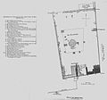
 HOPKINS(1899) p019 GONDER'S TOMB (discovered 1881 by Major Conder).jpg 1,085 × 996; 482 KB
-

-
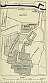
 HOPKINS(1899) p013 MAP OF JERUSALEM.jpg 443 × 587; 213 KB
_et_de_Saulcy_(Voyage_en_Terre_Sainte).jpg)

.jpg)
.jpg)
.jpg)
.jpg)
.jpg)
.jpg)


.jpg)
_(14776331812).jpg)
_JERUSALEM.jpg)
.jpg)
.jpg)

.jpg)
.jpg)
_p219_AL_KUDS_-_JERUSALEM_OF_TO-DAY.jpg)
_p019_GONDER%27S_TOMB_(discovered_1881_by_Major_Conder).jpg)
.jpg)
_p013_MAP_OF_JERUSALEM.jpg)