Category:1890 United States gubernatorial election maps
Jump to navigation
Jump to search
Media in category "1890 United States gubernatorial election maps"
The following 16 files are in this category, out of 16 total.
-
1890 Alabama gubernatorial election results map by county.svg 800 × 1,254; 844 KB
-
1890 Arkansas gubernatorial election results map by county.svg 800 × 699; 959 KB
-
1890 Colorado gubernatorial election results map by county.svg 800 × 579; 36 KB
-
1890 Minnesota gubernatorial election results map by county.svg 800 × 915; 815 KB
-
1890 North Dakota gubernatorial election results map by county.svg 800 × 479; 505 KB
-
1890 Oregon gubernatorial election results map by county.svg 800 × 589; 33 KB
-
1890 Pennsylvania gubernatorial election results map by county.svg 810 × 471; 50 KB
-
1890 South Carolina gubernatorial election results map by county.svg 800 × 638; 951 KB
-
1890 Tennessee gubernatorial election results map by county.svg 810 × 206; 93 KB
-
1890 Texas gubernatorial election results map by county.svg 800 × 759; 3.49 MB
-
1890 Vermont gubernatorial election results map by county.svg 810 × 810; 18 KB
-
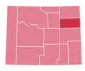
1890 Wyoming gubernatorial election results map by county.svg 810 × 624; 8 KB
-
1890 Wyoming Gubernatorial Election.png 921 × 767; 21 KB
-
1890SCGovResults.png 300 × 237; 8 KB
-
Map of Results of Colorado Gubernatorial Election 1890, by county.png 1,280 × 1,010; 56 KB


