Category:1889 maps of Asia
Jump to navigation
Jump to search
Temperate regions: North America · South America · Africa · Europe · Asia · – Polar regions: – Other regions:
English: 1889 maps of Asia
Español: Mapas de Asia en 1889
Subcategories
This category has the following 4 subcategories, out of 4 total.
Media in category "1889 maps of Asia"
The following 22 files are in this category, out of 22 total.
-

-
 1889 map of Central Asia, Comprising Turkestan, Afghanistan. Beluchistan, & N.W. India.jpg 4,146 × 6,591; 6.83 MB
-

-

-
 345 of '(Handbook of Commercial Geography.)' (11219544073).jpg 2,304 × 1,426; 728 KB
-
 351 of 'Handbook of Commercial Geography' (11201629264).jpg 2,288 × 1,420; 745 KB
-

-

-
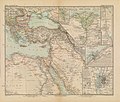 Afrika in 6 Blättern, Sheet 2. - DPLA - 39177aedfe3e739eea71ac7e1c8552db.jpg 1,000 × 846; 263 KB
-
 Map of Guangdong Province, China, 1889.jpg 3,942 × 2,688; 2.22 MB
-

-
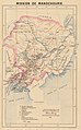 Mission de Mandchourie.jpg 1,589 × 2,560; 1.08 MB
-
 Mission du Kouang-si.jpg 1,772 × 1,081; 1.77 MB
-
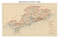 Mission du Kouang-tong.jpg 2,362 × 1,473; 3.6 MB
-
 Mission du Kouy-tcheou.jpg 1,890 × 1,200; 1.95 MB
-
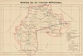 Mission du Su-tchuen méridional.jpg 1,772 × 1,196; 1.91 MB
-
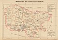 Mission du Su-tchuen occidental.jpg 1,772 × 1,204; 2.14 MB
-
 Mission du Su-tchuen oriental.jpg 1,890 × 1,264; 2.07 MB
-
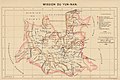 Mission du Yun-nan.jpg 1,772 × 1,178; 1.98 MB
-

-

-

.jpg)

.jpg)
.jpg)
%27_(11219544073).jpg)
.jpg)
.jpg)
%27_(11202159273).jpg)


_(cropped).jpg)


.jpg)
.jpg)
.jpg)